High water events on America's rivers often leave the floodplains enriched and improved for wildlife and fish. However, over-the-bank river flow can damage property, make soil difficult to farm, and even imperil people.
There are responsible, affordable voluntary ways to lessen flooding where property interests are at stake, while reducing long-term risk and building environmental, fisheries and wildlife benefits.
Landowners who provide habitat on their floodplain properties produce a more diverse wildlife community. If they make conservation-directed land use decisions they also benefit others. Allowing a floodplain to receive over-the-bank river flow results in:
- Diminished flood crests elsewhere in the watershed
- Enhanced safety by lessening the chance of a catastrophic levee or dam break
- Reduced need and costs for emergency services, and
- Quicker and cheaper clean-ups where flooding in developed areas occurs
Other societal benefits when high waters flow unimpeded into their floodplains:
- Habitats improve
- Groundwater is recharged
- Native fish feed more naturally and might be more likely to spawn successfully
- Water quality improves as nutrient-rich sediments and nitrates become available to floodplain trees, shrubs and wildflowers
- Native plant species that require occasional high water pulses grow more vigorously
Sand County Foundation has focused on building landowner and agency partnerships that can produce scientifically-sound and voluntary approaches to enhanced private land high water conservation. Poorly-engineered dams that are beyond their design life and old levees are unsafe structures that impede a river's high water flow and put people who are downstream at risk.
A key to overall river improvement is developing incentives for private landowners to choose land uses that keep floodplain hydrologic functions intact. Sand County Foundation has encouraged research and education on voluntary approaches that lead to better lands, waters, and human well-being. Within both the Baraboo and Wisconsin rivers, Sand County Foundation has pursued innovative and voluntary land-conserving actions, such as removing decrepit sand dike levees.
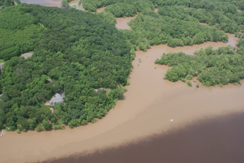
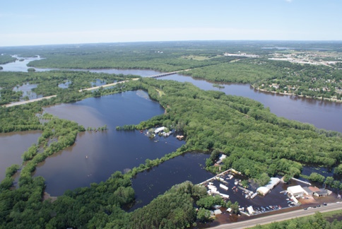
The photographs below were taken over the floodplains of the Baraboo and Wisconsin rivers on June 13, 2008. Some illustrate the negative consequences to people and infrastructure (an interstate highway) when a floodway is overwhelmed by heavy rains. They also suggest how landowners could use their floodplain properties in ways that benefit wildlife and water quality, lead to less intense flooding, and aid public safety.
Images from a flood on Wisconsin's Baraboo River
Wisconsin River with Baraboo River’s two channel effects evident in upper part of photo.
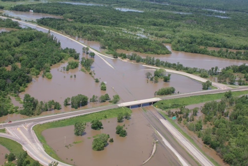
Baraboo River at Interstate Highway 90-94.
Baraboo River flow slowed by an aged levee.
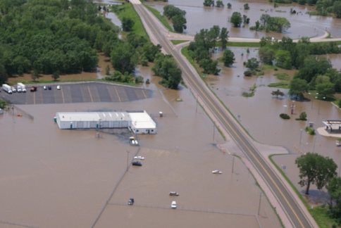
Baraboo River over State Highway 33 at intersection with Interstate Highways 90-94.

Baraboo River over ramp at State Highway 33 and Interstate Highways 90-94.
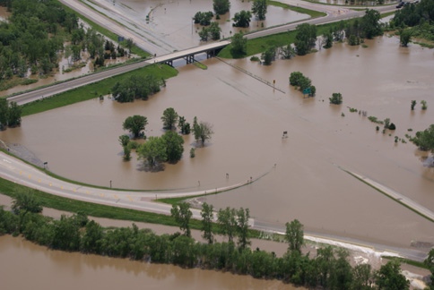
Baraboo River overtopping Interstate Highway 90-94 at the State Highway 33 interchange.
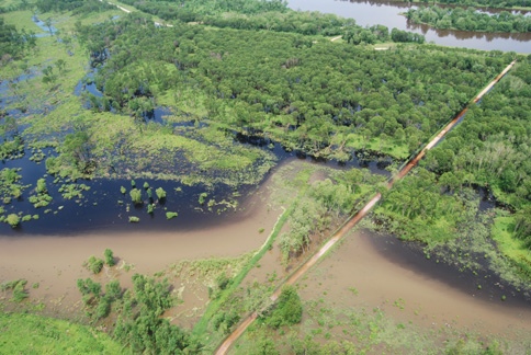
Baraboo River polluted water impeded by sand dike levee on Wisconsin River west of Portage.
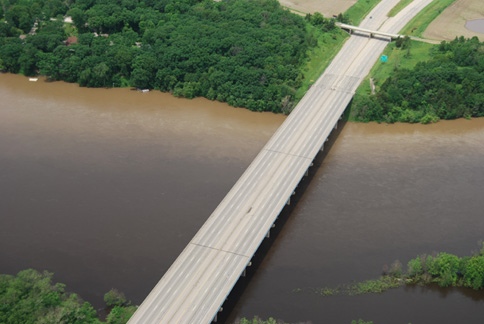
Wisconsin River with Interstate Highway 90-94 bridge, southwest of Portage.